Trail Walking Ighil N'Oumgoun - Bhouttra 230426 - Photo
© OpenStreetMap contributors
Length
Length
961 m
Max alt
Max alt
1604 m
Uphill gradient
Uphill gradient
25 m
Km-Effort
Km-Effort  
1.2 km
Min alt
Min alt
1574 m
Downhill gradient
Downhill gradient
4 m
Boucle
Boucle
No
Creation date :
2023-04-26 10:23:37.085
Updated on :
2023-04-26 11:17:55.252

(0 Reviews)

Walking
Walking
53m
Difficulty : Easy

Scan this QR Code to open this trail in the SityTrail application

FREE GPS app for hiking

Logo SityTrail SityTrail

IGN / Geographical institutes

Download SityTrail from the App Store Download SityTrail from Google Play

Logo SityTrail SityTrail World

The world is yours!

Download SityTrail from the App Store Download SityTrail from Google Play Download SityTrail on Huawei AppGallery

About

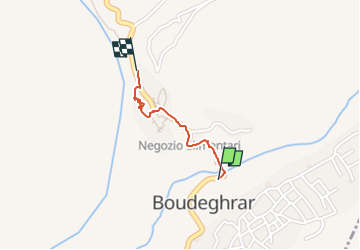
Trail Walking of 961 m to be discovered at Drâa-Tafilalet, cercle de Boulmane-Dadès, Ighil N'Oumgoun. This trail is proposed by JohnTompa.

Elevation profile

Positioning

Country:
Morocco
Region :
Drâa-Tafilalet
Department/Province :
cercle de Boulmane-Dadès
Municipality :
Ighil N'Oumgoun
Location:
Unknown
Start:(UTM)
772997 ; 3476169 (29R) N.

Trails nearby

Trail Walking Ighil N'Oumgoun - El hot - Photo
Walking
katiab

Walking

Difficult
Ighil N'Oumgoun, Drâa-Tafilalet, cercle de Boulmane-Dadès, Morocco
10.6 km | 13.2 km-effort
3h 5min
Yes


Close
My subscriptions